
Scituate 🇺🇸
-
Nautical Twilight begins:04:26 amSunrise:05:35 am
-
Sunset:07:45 pmNautical Twilight ends:08:54 pm
-
Moonrise:03:22 am
-
Moonset:02:27 pm
-
Moon over:08:54 am
-
Moon under:09:06 pm
-
Visibility:26%
-
 Waning Crescent
-
Distance to earth:363,640 kmProximity:98.7 %
Moon Phases for Scituate
-
good Day
-
minor Time:02:22 am - 04:22 am
-
major Time:07:54 am - 09:54 am
-
minor Time:01:27 pm - 03:27 pm
-
major Time:08:06 pm - 10:06 pm
Tide Clock
Tide Graph
Times
| Tide | Time | Height |
|---|---|---|
| low | 01:46 am | 1.05 ft |
| high | 07:41 am | 8.86 ft |
| low | 02:22 pm | 0.16 ft |
| high | 08:23 pm | 8.66 ft |
| Date | Major Bite Times | Minor Bite Times | Sun | Moon | Moonphase | Tide Times |
|---|---|---|---|---|---|---|
|
Fri, 03 May
|
07:54 am -
09:54 am
08:06 pm -
10:06 pm
|
02:22 am -
04:22 am
01:27 pm -
03:27 pm
|
R: 05:35 am S: 07:45 pm |
R: 03:22 am S: 02:27 pm |
Waning Crescent |
low: 01:46 am
, 1.05 ft
high: 07:41 am
, 8.86 ft
, Coeff: 110
low: 02:22 pm
, 0.16 ft
high: 08:23 pm
, 8.66 ft
, Coeff: 106
|
|
Sat, 04 May
|
08:45 am -
10:45 am
08:56 pm -
10:56 pm
|
02:46 am -
04:46 am
02:44 pm -
04:44 pm
|
R: 05:33 am S: 07:46 pm |
R: 03:46 am S: 03:44 pm |
Waning Crescent |
low: 02:49 am
, 0.52 ft
high: 08:45 am
, 9.06 ft
, Coeff: 114
low: 03:19 pm
, -0.07 ft
high: 09:19 pm
, 9.28 ft
, Coeff: 119
|
|
Sun, 05 May
|
09:34 am -
11:34 am
09:46 pm -
11:46 pm
|
03:08 am -
05:08 am
04:01 pm -
06:01 pm
|
R: 05:32 am S: 07:47 pm |
R: 04:08 am S: 05:01 pm |
Waning Crescent |
low: 03:49 am
, -0.1 ft
high: 09:45 am
, 9.25 ft
, Coeff: 119
low: 04:12 pm
, -0.3 ft
high: 10:12 pm
, 9.84 ft
, Coeff: 131
|
|
Mon, 06 May
|
10:25 am -
12:25 pm
10:39 pm -
12:39 am
|
03:31 am -
05:31 am
05:20 pm -
07:20 pm
|
R: 05:31 am S: 07:48 pm |
R: 04:31 am S: 06:20 pm |
New Moon |
low: 04:45 am
, -0.69 ft
high: 10:42 am
, 9.42 ft
, Coeff: 122
low: 05:04 pm
, -0.43 ft
high: 11:02 pm
, 10.3 ft
, Coeff: 141
|
|
Tue, 07 May
|
11:19 am -
01:19 pm
11:03 pm -
01:03 am
|
03:58 am -
05:58 am
06:41 pm -
08:41 pm
|
R: 05:30 am S: 07:49 pm |
R: 04:58 am S: 07:41 pm |
New Moon |
low: 05:39 am
, -1.15 ft
high: 11:36 am
, 9.48 ft
, Coeff: 124
low: 05:53 pm
, -0.46 ft
high: 11:51 pm
, 10.6 ft
, Coeff: 147
|
|
Wed, 08 May
|
12:14 pm -
02:14 pm
11:55 pm -
01:55 am
|
04:29 am -
06:29 am
08:00 pm -
10:00 pm
|
R: 05:29 am S: 07:50 pm |
R: 05:29 am S: 09:00 pm |
New Moon |
low: 06:30 am
, -1.38 ft
high: 12:28 pm
, 9.42 ft
, Coeff: 122
low: 06:42 pm
, -0.33 ft
|
|
Thu, 09 May
|
12:46 am -
02:46 am
01:10 pm -
03:10 pm
|
05:06 am -
07:06 am
09:15 pm -
11:15 pm
|
R: 05:27 am S: 07:51 pm |
R: 06:06 am S: 10:15 pm |
New Moon |
high: 12:39 am
, 10.63 ft
, Coeff: 148
low: 07:20 am
, -1.38 ft
high: 01:18 pm
, 9.22 ft
, Coeff: 118
low: 07:30 pm
, -0.1 ft
|


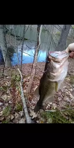
uploaded by: John Needham

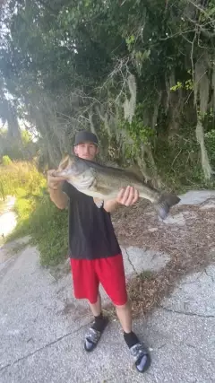
uploaded by: Lee Smith 1

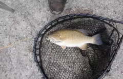
uploaded by: D2Turnt

uploaded by: PT Edward fisher

uploaded by: Charlie Pifer

uploaded by: Charlie Pifer

uploaded by: Charlie Pifer

uploaded by: Charlie Pifer

uploaded by: bariu

uploaded by: bariu
Best Fishing Spots in the greater Scituate area
Beaches and Bays are ideal places for land-based fishing. If the beach is shallow and the water is clear then twilight times are usually the best times, especially when they coincide with a major or minor fishing time. Often the points on either side of a beach are the best spots. Or if the beach is large then look for irregularities in the breaking waves, indicating sandbanks and holes. We found 8 beaches and bays in this area.
Peggotty Beach - 1km , North Scituate Beach - 5km , Minot Beach - 6km , Humarock Beach - 7km , Bassing Beach - 7km , Sandy Beach - 9km , Pleasant Beach - 10km , Black Rock Beach - 11km
Harbours and Marinas can often times be productive fishing spots for land based fishing as their sheltered environment attracts a wide variety of bait fish. Similar to river mouths, harbour entrances are also great places to fish as lots of fish will move in and out with the rising and falling tides. There are 4 main harbours in this area.
Scituate Harbor Marina - 1km, Scituate Harbor - 1km, Briggs Harbor - 7km, Little Harbor - 9km
We found a total of 99 potential fishing spots nearby Scituate. Below you can find them organized on a map. Points, Headlands, Reefs, Islands, Channels, etc can all be productive fishing spots. As these are user submitted spots, there might be some errors in the exact location. You also need to cross check local fishing regulations. Some of the spots might be in or around marine reserves or other locations that cannot be fished. If you click on a location marker it will bring up some details and a quick link to google search, satellite maps and fishing times. Tip: Click/Tap on a new area to load more fishing spots.
Scituate Harbor Marina - 1km , Scituate Harbor - 1km , Peggotty Beach - 1km , Cedar Point - 1km , Old Sow - 2km , Sheep Ponds - 3km , Old Oaken Bucket Pond Dam - 3km , Wood Island - 3km , Tack Factory Pond - 3km , Tar Pouch - 3km , Bear Island - 3km , Herring River - 3km , First Herring Brook Reservoir Dam - 3km , Wills Island - 3km , New Inlet - 4km , Musquashcut Pond - 4km , Bartletts Island - 4km , Trouant Island - 4km , North Scituate Beach - 5km , Macombers Island - 5km , Lewis Pond - 5km , Damon Point Road Dam - 5km , Bog Dam - 5km , Torrey Pond Dam - 6km , South Entering Rock - 6km , Minot Beach - 6km , Tilden Island - 6km , Horse Island - 6km , Turner Pond - 6km , Turner Pond Dam - 6km , Wales Pond - 6km , Well Rock - 6km , Bar Rock - 6km , Humarock Beach - 7km , Briggs Harbor - 7km , Tobias Ledge - 7km , Bryant Point - 7km , Bates Rock - 7km , White Rock - 7km , Hog Rock - 7km , Bassing Beach - 7km , Cohasset Cove - 7km , Scituate Neck - 7km , Supper Island - 7km , Gulf Island - 7km , Black Pond - 7km , Government Island - 7km , Turtle Island - 7km , Strawberry Point - 7km , West Willies - 8km , Cohasset Harbor - 8km , Big Quamino Rock - 8km , Treat Pond - 8km , Aaron River Dam - 8km , Windmill Point - 8km , Little White Head - 8km , Little Quamino Rock - 8km , East Shag Rock - 8km , East Round Rock - 8km , Eastern Channel - 8km , Sandy Cove - 8km , Lily Pond - 8km , Gull Island - 8km , Jack Rock - 8km , Quarry Point - 8km , Oakman Pond - 9km , Bound Brook Pond Dam - 9km , Sylvester Rock - 9km , Magoun Pond Dam - 9km , Brush Island - 9km , Buckthorn Rock - 9km , Hogshead Rock - 9km , Western Channel - 9km , Westerly Round Rock - 9km , West Shag Rock - 9km , Chittenden Rock - 9km , West Hogshead Rock - 9km , Mink Island - 9km , Hatch Pond - 9km , Mounce Pond - 9km , Little Harbor - 9km , East Hogshead Rock - 9km , Barrel Rock - 9km , Sandy Beach - 9km , Kimballs Point - 9km , Sanctuary Pond - 10km , The Island - 10km , Nichols Road Dam - 10km , Pleasant Beach - 10km , Furnace Pond - 10km , Black Rock Beach - 11km , Marshfield Neck - 11km , Jacobs Pond Dam - 11km , Mill Pond - 11km , Parsons Pond - 11km , Peterson Pond - 11km , Gun Rock - 12km , Green Hill Rock - 12km , Chandlers Pond - 12km
Comments